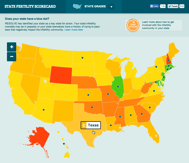
I created an interactive fertility map that renders fertility statistics for all US states. I chose the jVectorMap library because it was (and probably still is) one of the only tools that supports scalable vector graphics in IE6. I packaged the project using JSON as acting database to ensure its portability as a standalone website that could easily be dropped into any environment.
